J0313 : Border complexities on Captain's Road
taken 6 years ago, 3 km from Forkhill, Co Armagh, Northern Ireland
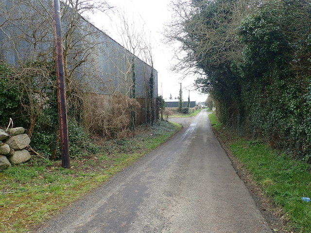
Border complexities on Captain's Road.
The shed in the foreground photographed here from UK territory is in the Republic. Beyond the shed the border crosses the road and follows the line of the hedge. Beyond the second shed Captain's Road re-enters the Republic. This border crossing was spiked in the 1950s and again in the 1970s. Locals then removed the spikes and no attempt was made to replace them.
Link
Link
![Creative Commons Licence [Some Rights Reserved]](https://s1.geograph.org.uk/img/somerights20.gif)
|
· Find out How to reuse this image ·
Share:
|
|||||
| Start a discussion on J0313 | Suggest an update to this image | Contact the contributor | |||
Loading map... (JavaScript required)
- Grid Square
- J0313, 45 images (more nearby
 )
)
- Photographer
- Eric Jones (find more nearby)
- Date Taken
- Monday, 9 April, 2018 (more nearby)
- Submitted
- Wednesday, 18 April, 2018
- Geographical Context
- Subject Location
-
Irish:
 J 033 135 [100m precision]
WGS84: 54:3.6440N 6:25.3806W - Camera Location
-
Irish: J 032 135
- View Direction
- Southeast (about 135 degrees)
This page has been viewed about 16 times.
View this location:
KML (Google Earth) ·
Google Maps ·
Bing Maps ·
Geograph Coverage Map ·
More Links for this image