1993
NS4969 : John Brown shipyard
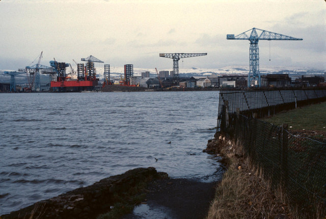
taken 31 years ago, near to Clydebank, West Dunbartonshire, Scotland
This is 1 of 3 images, with title starting with John Brown in this square
John Brown shipyard
Taken from where the river Cart meets the Clyde, next to Renfrew golf course. The path by the rivers has since been repaired so you don't need to go over the fence.
John Brown's built oil rigs at the time.
John Brown's built oil rigs at the time.
 Map © Crown Copyright")
TIP: Click the map for more Large scale mapping
- Grid Square
- NS4969, 254 images (more nearby 🔍)
- Photographer
- Ewan Carmichael Douglas (more nearby)
- Contributed by
- David Douglas (more nearby)
- Date Taken
- February 1993 (more nearby)
- Submitted
- Friday, 11 May, 2018
- Subject Location
-
OSGB36:
 NS 499 694 [100m precision]
WGS84: 55:53.6943N 4:24.0591W - Camera Location
-
OSGB36: NS 497 690
- View Direction
- North-northeast (about 22 degrees)