2018
NT9265 : Fleurs Dean
taken 6 years ago, near to Coldingham, Scottish Borders, Scotland
This is 1 of 2 images, with title Fleurs Dean in this square
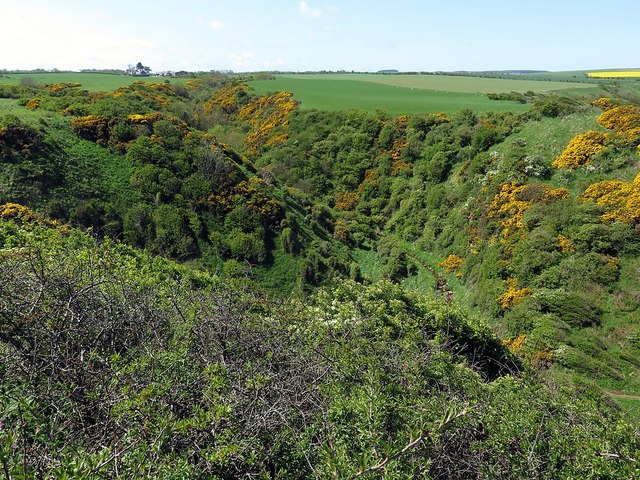
Fleurs Dean
Originally shown as 'Floors Dean'.
"Extending East from the farm house of Floors. A steep rocky ravine or cleugh on the farm of Floors - from which it derives its name. Extending in an Easterly direction until its junction with Hallydown Dean. Thence in a Northerly direction to Hallydown Shore where it terminates, its sides are precipitous and covered with rough pasture and furze - interspersed with bushes."
Link
 Map © Crown Copyright")
TIP: Click the map for more Large scale mapping
- Grid Square
- NT9265, 92 images (more nearby 🔍)
- Photographer
- Andrew Curtis (more nearby)
- Date Taken
- Wednesday, 16 May, 2018 (more nearby)
- Submitted
- Saturday, 19 May, 2018
- Subject Location
-
OSGB36:
 NT 9237 6537 [10m precision]
WGS84: 55:52.8852N 2:7.4121W - Camera Location
-
OSGB36: NT 92473 65363
- View Direction
- WEST (about 270 degrees)