2018
SO0553 : Summit of Caer Fawr and view east
taken 6 years ago, near to Llanelwedd, Powys, Wales
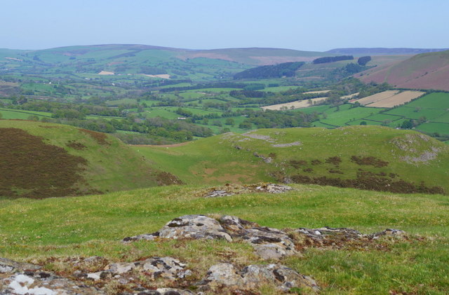
Summit of Caer Fawr and view east
Looking out over the top of the neighbouring spur of Caer Einon (another hill fort) to more valleys and hills beyond. The highest hill on the left skyline is Gwaunceste Hill - view direction slightly north of east.
 Map © Crown Copyright")
TIP: Click the map for more Large scale mapping
- Grid Square
- SO0553, 4 images (more nearby 🔍)
- Photographer
- Andrew Hill (more nearby)
- Date Taken
- Thursday, 17 May, 2018 (more nearby)
- Submitted
- Sunday, 20 May, 2018
- Subject Location
-
OSGB36:
 SO 0582 5306 [10m precision]
WGS84: 52:10.0644N 3:22.7062W - Camera Location
-
OSGB36: SO 0580 5306
- View Direction
- EAST (about 90 degrees)