2018
SO5977 : Site of demolished radar installation on Titterston Clee Hill
taken 6 years ago, near to Cleeton st Mary, Shropshire, England
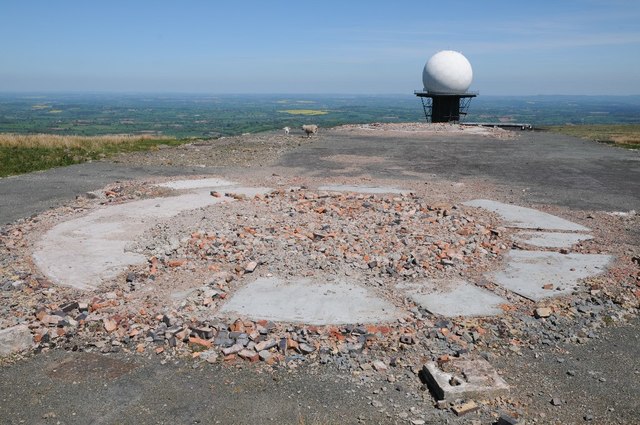
Site of demolished radar installation on Titterston Clee Hill
Site of demolished radar installation buildings on Titterston Clee Hill, they can be seen in this picture from April 2016SO5977 : Radar station on Titterstone Clee. In the background is the Air traffic control beacon.
 Map © Crown Copyright")
TIP: Click the map for more Large scale mapping
- Grid Square
- SO5977, 405 images (more nearby 🔍)
- Photographer
- Philip Halling (more nearby)
- Date Taken
- Monday, 14 May, 2018 (more nearby)
- Submitted
- Sunday, 20 May, 2018
- Subject Location
-
OSGB36:
 SO 5928 7793 [10m precision]
WGS84: 52:23.8717N 2:35.9928W - Camera Location
-
OSGB36: SO 5924 7793
- View Direction
- East-northeast (about 67 degrees)