2018
SE2641 : North end of Paul's Pond, Breary Marsh SSSI
taken 6 years ago, near to Cookridge, Leeds, England
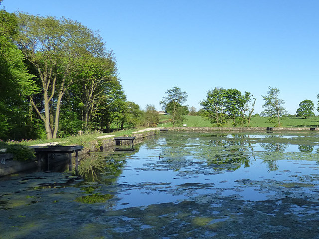
North end of Paul's Pond, Breary Marsh SSSI
Showing the several fishers' platforms along the dam.
Breary Marsh nature reserve
Breary Marsh is a SSSI (Site of Special Scientific Interest) to the west of A660 Otley Road in north Leeds managed by Leeds City Council. According to the information board on site, it comprises a variety of habitats including oak and birch woodland, alder carr, fen, willow scrub, flower meadow, pond and streams.
 Map © Crown Copyright")
TIP: Click the map for more Large scale mapping
- Grid Square
- SE2641, 90 images (more nearby 🔍)
- Photographer
- Stephen Craven (more nearby)
- Date Taken
- Monday, 14 May, 2018 (more nearby)
- Submitted
- Tuesday, 22 May, 2018
- Subject Location
-
OSGB36:
 SE 2613 4131 [10m precision]
WGS84: 53:52.0410N 1:36.2476W - Camera Location
-
OSGB36: SE 2609 4132
- View Direction
- EAST (about 90 degrees)