2007
SJ6545 : Cattle Grazing, near Audlem, Cheshire
taken 17 years ago, near to Hankelow, Cheshire East, England
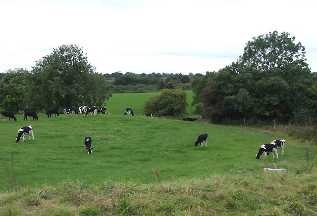
Cattle Grazing, near Audlem, Cheshire
This scene is typical of much of the prime dairy farming parts of Cheshire. The rough grass in the foreground is the bank of the canal. The level embankment at the far end of the second field carried the (now dismantled) railway.
The Nantwich and Market Drayton Railway was built in 1863. The railway was never an economic success and Audlem Station was finally closed in 1964.
The Nantwich and Market Drayton Railway was built in 1863. The railway was never an economic success and Audlem Station was finally closed in 1964.
 Map © Crown Copyright")
TIP: Click the map for more Large scale mapping
- Grid Square
- SJ6545, 71 images (more nearby 🔍)
- Photographer
- Roger D Kidd (more nearby)
- Date Taken
- Friday, 31 August, 2007 (more nearby)
- Submitted
- Monday, 8 October, 2007
- Subject Location
-
OSGB36:
 SJ 650 455 [100m precision]
WGS84: 53:0.3614N 2:31.3554W - Camera Location
-
OSGB36: SJ 651 456
- View Direction
- West-southwest (about 247 degrees)