S8052 : Forest Clearing
taken 6 years ago, 6 km NE of Ballymurphy, Co Carlow, Ireland
Forest Clearing
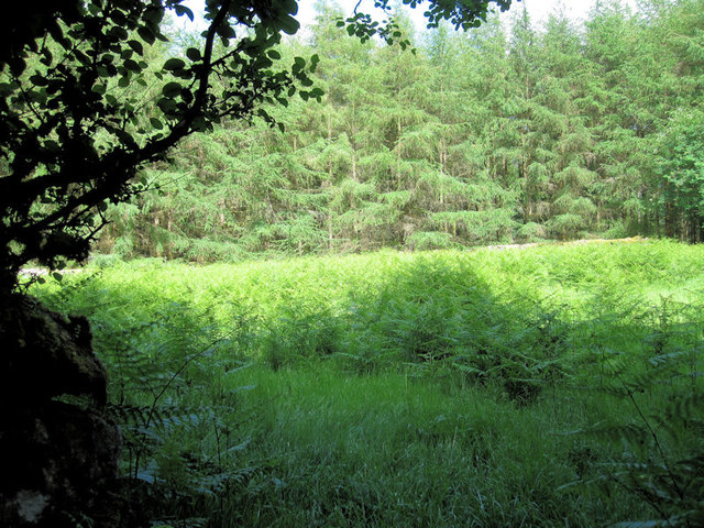
This walled enclosure, now a forest clearing is thought to be the sight of a 'Cillín'. This was the site, unconsecrated ground, used for the burial of infants who died before baptism and this may explain the reason for its being kept clear of commercial planting.
![Creative Commons Licence [Some Rights Reserved]](https://s1.geograph.org.uk/img/somerights20.gif)
|
· Find out How to reuse this image ·
Share:
|
|||||
| Start a discussion on S8052 | Suggest an update to this image | Contact the contributor | |||
Loading map... (JavaScript required)
- Grid Square
- S8052, 3 images (more nearby
 )
)
- Photographer
- kevin higgins (find more nearby)
- Date Taken
- Thursday, 14 June, 2018 (more nearby)
- Submitted
- Friday, 15 June, 2018
- Geographical Context
- Subject Location
-
Irish:
 S 804 520 [100m precision]
WGS84: 52:36.8210N 6:48.7466W - Camera Location
-
Irish: S 804 519
- View Direction
- East-northeast (about 67 degrees)
Image Type (about):
cross grid
This page has been viewed about 78 times.
View this location:
KML (Google Earth) ·
Google Maps ·
Bing Maps ·
Geograph Coverage Map ·
More Links for this image
·
Bing Maps ·
Geograph Coverage Map ·
More Links for this image