2018
TM1740 : Orwell Bridge
taken 6 years ago, near to Freston, Suffolk, England
This is 1 of 3 images, with title Orwell Bridge in this square
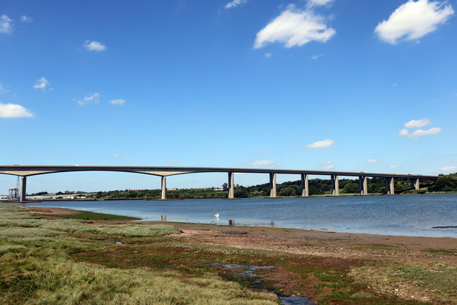
Orwell Bridge
The Orwell Bridge was opened to road traffic in 1982 and carries the A14 (then A45) over the River Orwell just south of Ipswich in Suffolk, England.
The main span is 190 metres which, at the time of its construction, was the longest pre-stressed concrete span in use. The total length is 1,287 metres from Wherstead to the site of the former Ipswich Airport. The width is 24 metres with a height of 43 metres.
Wikipedia:
Link
See other images of The Orwell Bridge
 Map © Crown Copyright")
TIP: Click the map for more Large scale mapping
- Grid Square
- TM1740, 86 images (more nearby 🔍)
- Photographer
- PAUL FARMER (more nearby)
- Date Taken
- Monday, 18 June, 2018 (more nearby)
- Submitted
- Tuesday, 19 June, 2018
- Subject Location
-
OSGB36:
 TM 171 407 [100m precision]
WGS84: 52:1.3482N 1:9.8067E - Camera Location
-
OSGB36: TM 173 412
- View Direction
- South-southwest (about 202 degrees)