S5010 : Old Bridge on the Waterford Greenway near Kilmeadan
taken 6 years ago, near to Ballyduff, Co Waterford, Ireland
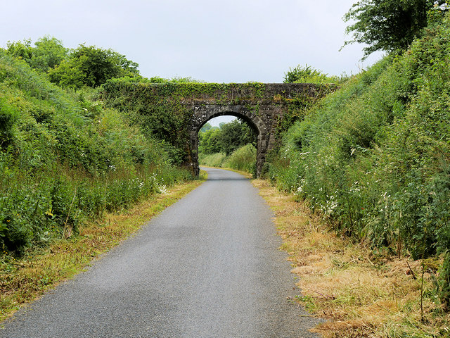
Old Bridge on the Waterford Greenway near Kilmeadan
The Waterford Greenway is a spectacular off-road cycling and walking trail along an old railway line between Waterford and Dungarvan. It opened in 2017 and runs between the city of Waterford, Mount Congreve, Kilmeaden, Kilmacthomas, and Dungarvan. At 46km, it is Ireland's longest greenway.
![Creative Commons Licence [Some Rights Reserved]](https://s1.geograph.org.uk/img/somerights20.gif)
|
· Find out How to reuse this image ·
Share:
|
|||||
| Start a discussion on S5010 | Suggest an update to this image | Contact the contributor | |||
Loading map... (JavaScript required)
- Grid Square
- S5010, 2 images (more nearby
 )
)
- Photographer
- David Dixon (find more nearby)
- Date Taken
- Sunday, 17 June, 2018 (more nearby)
- Submitted
- Wednesday, 27 June, 2018
- Geographical Context
- Camera (from Tags)
- Subject Location
-
Irish:
 S 508 106 [100m precision]
WGS84: 52:14.7638N 7:15.3486W - Camera Location
-
Irish: S 509 107
- View Direction
- WEST (about 270 degrees)
Other Tags
This page has been viewed about 95 times.
View this location:
KML (Google Earth) ·
Google Maps ·
Bing Maps ·
Geograph Coverage Map ·
More Links for this image
·
Bing Maps ·
Geograph Coverage Map ·
More Links for this image