S5511 : The Banks of the Suir near Carriganore
taken 6 years ago, 4 km NE of Ballyduff, Co Waterford, Ireland
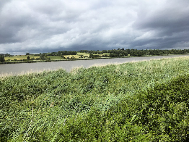
The Banks of the Suir near Carriganore
The River Suir (Irish: An tSiúr) rises on the slopes of Devil's Bit Mountain, just north of Templemore in County Tipperary, and flows for 185 km (115 miles) to its estuary at Waterford Harbour. This is the view of the river as seen from the Waterford and Suir Valley Railway.
![Creative Commons Licence [Some Rights Reserved]](https://s1.geograph.org.uk/img/somerights20.gif)
|
· Find out How to reuse this image ·
Share:
|
|||||
| Start a discussion on S5511 | Suggest an update to this image | Contact the contributor | |||
Loading map... (JavaScript required)
- Grid Square
- S5511, 2 images (more nearby
 )
)
- Photographer
- David Dixon (find more nearby)
- Date Taken
- Sunday, 17 June, 2018 (more nearby)
- Submitted
- Wednesday, 27 June, 2018
- Geographical Context
- Camera (from Tags)
- River (from Tags)
- Subject Location
-
Irish:
 S 553 118 [100m precision]
WGS84: 52:15.3583N 7:11.4550W - Camera Location
-
Irish: S 552 117
- View Direction
- North-northeast (about 22 degrees)
Other Tags
This page has been viewed about 49 times.
View this location:
KML (Google Earth) ·
Google Maps ·
Bing Maps ·
Geograph Coverage Map ·
More Links for this image
·
Bing Maps ·
Geograph Coverage Map ·
More Links for this image