S5409 : N25, Tramore Crossroad Bridge
taken 6 years ago, 3 km from Ballyduff, Co Waterford, Ireland
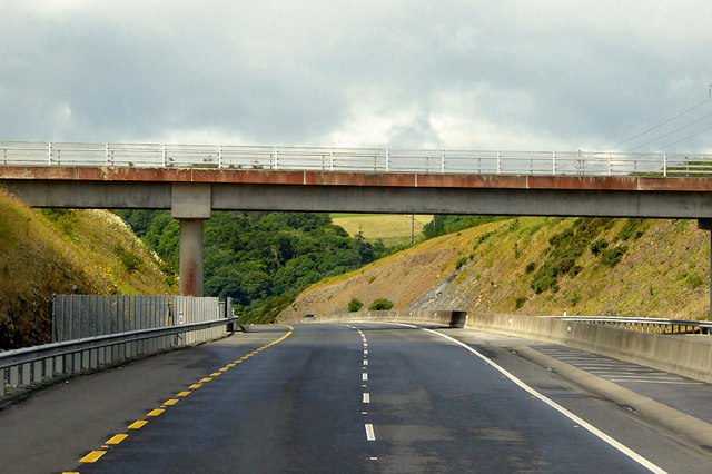
N25, Tramore Crossroad Bridge
Bridge carrying Tramore Crossroad (L4035) over the N25 in Co Waterford.
Irish National Primary Road N25
The N25 road is a national primary road in Ireland, forming the route from Cork to Rosslare Europort via Waterford City. The road is part of the E30 European route and a short section is also part of the E01 European route. It forms part of the proposed Atlantic Corridor route (Wikipedia).
![Creative Commons Licence [Some Rights Reserved]](https://s1.geograph.org.uk/img/somerights20.gif)
|
· Find out How to reuse this image ·
Share:
|
|||||
| Start a discussion on S5409 | Suggest an update to this image | Contact the contributor | |||
Loading map... (JavaScript required)
- Grid Square
- S5409, 3 images (more nearby
 )
)
- Photographer
- David Dixon (find more nearby)
- Date Taken
- Sunday, 17 June, 2018 (more nearby)
- Submitted
- Saturday, 30 June, 2018
- Geographical Context
- Camera (from Tags)
- Road (from Tags)
- Subject Location
-
Irish:
 S 545 096 [100m precision]
WGS84: 52:14.1926N 7:12.0998W - Camera Location
-
Irish: S 547 096
- View Direction
- WEST (about 270 degrees)
Other Tags
This page has been viewed about 41 times.
View this location:
KML (Google Earth) ·
Google Maps ·
Bing Maps ·
Geograph Coverage Map ·
More Links for this image
·
Bing Maps ·
Geograph Coverage Map ·
More Links for this image