2018
HU5438 : Confused water off Feadda Ness
taken 6 years ago, 4 km ESE of Brough, Bressay, Shetland Islands, Scotland
Confused water off Feadda Ness
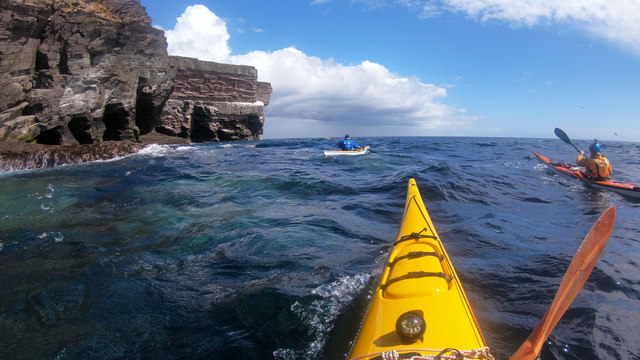
The rock over which the wave is just breaking (and water from the previous wave pouring off) is the southernmost point of the island of Noss at this state of the tide (lowish - early in the flood, near neaps). Turning this headland from the southwest coast starts to open up views of progressively more interesting rock scenery as well as increasing amounts of bird life. There are small caves just here, and a Geo between the first and second sections of cliff in this photo. I paddled into more sheltered water inside, where bigger caves awaited exploration, but in the rather confused water (southwesterly windwaves cutting across easterly swell) no-one seemed to want to join me and it's not a place to play without a bit of backup... The rock is a mix of sandstones and conglomerates of Devonian (Old Red Sandstone) age where layers of varying hardness have eroded into the many ledges which make the place such an attractive place for seabirds.
 Map © Crown Copyright")
TIP: Click the map for more Large scale mapping
- Grid Square
- HU5438, 6 images (more nearby 🔍)
- Photographer
- Andy Waddington (more nearby)
- Date Taken
- Wednesday, 20 June, 2018 (more nearby)
- Submitted
- Wednesday, 4 July, 2018
- Subject Location
-
OSGB36:
 HU 5493 3897 [10m precision]
WGS84: 60:7.8951N 1:0.7846W - Camera Location
-
OSGB36: HU 5488 3892
- View Direction
- Northeast (about 45 degrees)