2018
SE0412 : Stone Folds Lane, Marsden
taken 6 years ago, near to Marsden, Kirklees, England
This is 1 of 2 images, with title Stone Folds Lane, Marsden in this square
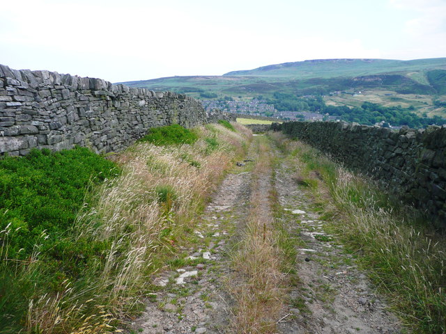
Stone Folds Lane, Marsden
Looking down towards the junction with the lane from Huck Hill Farm to High Fall Farm.
 Map © Crown Copyright")
TIP: Click the map for more Large scale mapping
- Grid Square
- SE0412, 74 images (more nearby 🔍)
- Photographer
- Humphrey Bolton (more nearby)
- Date Taken
- Thursday, 5 July, 2018 (more nearby)
- Submitted
- Saturday, 7 July, 2018
- Subject Location
-
OSGB36:
 SE 0453 1216 [10m precision]
WGS84: 53:36.3589N 1:55.9807W - Camera Location
-
OSGB36: SE 0451 1217
- View Direction
- East-southeast (about 112 degrees)