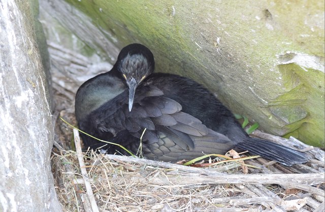
NM2742 : Nesting shag (Phalacrocorax aristotelis) on Lunga
taken 6 years ago, near to Sgeir a' Chaisteil [other Features], Argyll And Bute, Great Britain
Not to be confused with Lunga in the Firth of Lorn.
Lunga is the largest of the Treshnish isles which from NE to SW comprise Cairn na Burgh Beag & More, Fladda, a whole cluster of skerries around Sgeir an Eirionnaich, Lunga and finally Bac Mòr & Beag.
Lunga is home to thousands of seabirds, particularly guillemots and razorbills - and most famously puffins.
From my research of Scottish censuses, I believe that Lunga was abandoned in the mid C19th, as on the 1841 census 11 people are named as living on Lunga, of which seven had the surname Munro. By the 1861 census however I can find no-one with an address on the island.
The remains of former blackhouses can be found at the northern end of the island on the lowest slopes of Cruachan.
Statistics:
Area: 81ha (200 acres or ⅜ mile²)
Population: 0 (Abandoned mid C19th)
Highest Point: Cruachan 103m (338')
 Map © Crown Copyright")
- Grid Square
- NM2742, 54 images (more nearby 🔍)
- Photographer
- Rob Farrow (more nearby)
- Date Taken
- Monday, 2 July, 2018 (more nearby)
- Submitted
- Sunday, 8 July, 2018
- Subject Location
-
OSGB36:
 NM 278 421 [100m precision]
WGS84: 56:29.5401N 6:25.3805W - Camera Location
-
OSGB36: NM 278 421
- View Direction
- Southwest (about 225 degrees)