2018
SE3866 : River Tutt Flood Relief Channel
taken 6 years ago, near to Boroughbridge, North Yorkshire, England
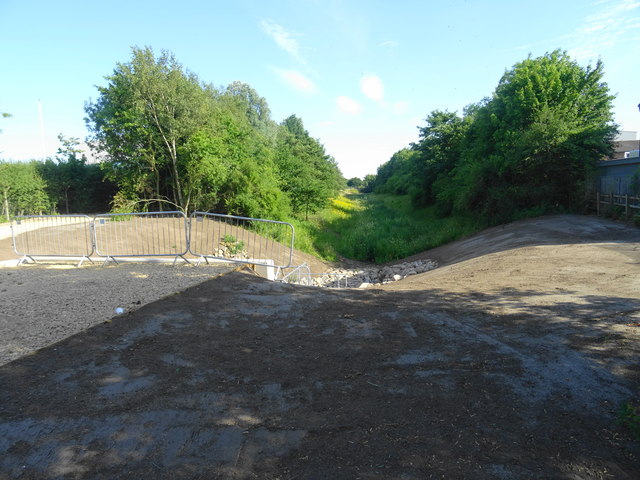
River Tutt Flood Relief Channel
The River Tutt flows through the centre of Boroughbridge to join the River Ure downstream of the town. This major channel provides storage upstream of the town with water discharged through a reconstructed outfall structure into River Ure upstream.
 Map © Crown Copyright")
TIP: Click the map for more Large scale mapping
- Grid Square
- SE3866, 32 images (more nearby 🔍)
- Photographer
- John M (more nearby)
- Date Taken
- Tuesday, 10 July, 2018 (more nearby)
- Submitted
- Tuesday, 10 July, 2018
- Subject Location
-
OSGB36:
 SE 388 662 [100m precision]
WGS84: 54:5.4311N 1:24.4614W - Camera Location
-
OSGB36: SE 388 662
- View Direction
- South-southeast (about 157 degrees)