2018
HU3621 : The Neapack from Loose Head
taken 6 years ago, near to Ireland, Mainland, Shetland Islands, Scotland
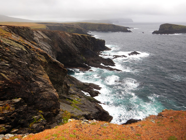
The Neapack from Loose Head
A day for walking round St. Ninian's Isle, looking down to see why we weren't sea kayaking round it. There are plenty of caves and geos, and skerries to rock-hop around in a bit of swell, but not this much ! There's quite a lot of wind waves, too, and whilst not as strong as it had been, the westerly was still quite gusty. The metamorphic rocks here are micaceous psammites of the Colla Firth group, Whiteness Division, and correlate with the Dalradian of mainland Scotland. They are dipping moderately steeply to the southwest, making for somewhat unstable and treacherous cliff edges, so the base of these cliffs is only readily seen from a bit that sticks out, as Loose Head does, offering a view back along the coast.
 Map © Crown Copyright")
TIP: Click the map for more Large scale mapping
- Grid Square
- HU3621, 32 images (more nearby 🔍)
- Photographer
- Andy Waddington (more nearby)
- Date Taken
- Friday, 22 June, 2018 (more nearby)
- Submitted
- Wednesday, 11 July, 2018
- Subject Location
-
OSGB36:
 HU 3601 2163 [10m precision]
WGS84: 59:58.6799N 1:21.3982W - Camera Location
-
OSGB36: HU 3611 2189
- View Direction
- South-southwest (about 202 degrees)