J1860 : The River Lagan, Spencer's Bridge, near Moira - July 2018(1)
taken 6 years ago, 3 km from Maghaberry, Co Antrim, Northern Ireland
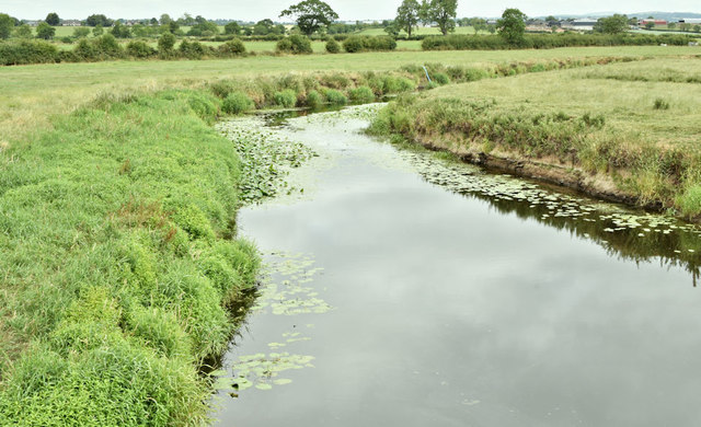
The River Lagan, Spencer's Bridge, near Moira - July 2018(1)
The River Lagan, looking downstream, from Spencers Bridge on the Lany Road, during the current long dry spell. There are water lilies growing on both sides. Note also the exposed and dry riverbank at middle right. For a seasonal comparison in water level see J1860 : The River Lagan, Spencer's Bridge near Moira (1) (June 2012).
![Creative Commons Licence [Some Rights Reserved]](https://s1.geograph.org.uk/img/somerights20.gif)
|
· Find out How to reuse this image ·
Share:
|
|||||
| Start a discussion on J1860 | Suggest an update to this image | Contact the contributor | |||
Loading map... (JavaScript required)
- Grid Square
- J1860, 19 images (more nearby
 )
)
- Photographer
- Albert Bridge (find more nearby)
- Date Taken
- Friday, 13 July, 2018 (more nearby)
- Submitted
- Friday, 13 July, 2018
- Geographical Context
- Primary Subject of Photo
- Subject Location
-
Irish:
 J 182 603 [100m precision]
WGS84: 54:28.6589N 6:10.5534W - Camera Location
-
Irish: J 182 603
- View Direction
- North-northeast (about 22 degrees)
Other Tags
This page has been viewed about 109 times.
View this location:
KML (Google Earth) ·
Google Maps ·
Bing Maps ·
Geograph Coverage Map ·
More Links for this image
·
Bing Maps ·
Geograph Coverage Map ·
More Links for this image