H5371 : Collapsed bridge and road, Bancran / Bracky
taken 6 years ago, 4 km NNW of Beragh, Co Tyrone, Northern Ireland
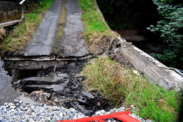
Collapsed bridge and road, Bancran / Bracky
And to think I've driven over this numerous times!
![Creative Commons Licence [Some Rights Reserved]](https://s1.geograph.org.uk/img/somerights20.gif)
|
· Find out How to reuse this image ·
Share:
|
|||||
| Start a discussion on H5371 | Suggest an update to this image | Contact the contributor | |||
Loading map... (JavaScript required)
- Grid Square
- H5371, 403 images (more nearby
 )
)
- Photographer
- Kenneth Allen (find more nearby)
- Date Taken
- Friday, 27 July, 2018 (more nearby)
- Submitted
- Friday, 27 July, 2018
- Geographical Context
- Subject Location
-
Irish:
 H 535 714 [100m precision]
WGS84: 54:35.3250N 7:10.3640W - Camera Location
-
Irish: H 535 715
- View Direction
- East-southeast (about 112 degrees)
Other Tags
Image Type (about):
close look
This page has been viewed about 29 times.
View this location:
KML (Google Earth) ·
Google Maps ·
Bing Maps ·
Geograph Coverage Map ·
More Links for this image
·
Bing Maps ·
Geograph Coverage Map ·
More Links for this image