2018
NM7734 : Lady's Rock and beacon
taken 6 years ago, 3 km from Kilpatrick, Isle of Mull, Argyll And Bute, Scotland
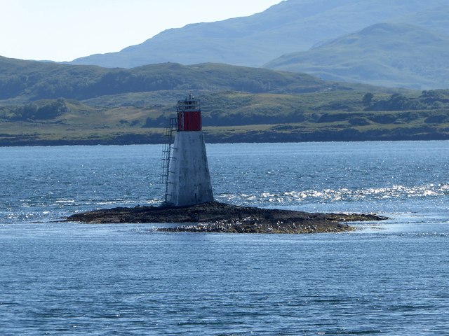
Lady's Rock and beacon
Lady's Rock is a skerry to the south west of Eilean Musdile. It is submerged at high tide and carries a navigation beacon with characteristics "Fl W 6s" meaning it Flashes a White light every 6 seconds. The light is 12m (39') above sea level with a range of 5 nautical miles.
There is a famous story associated with Lady's Rock from whence it gets its name:
Nearby to the rock is the strategically positioned Duart Castle from which the rock can be seen. Lachlan Cattanach Maclean of Duart, 11th Chief of the Clan Maclean had had at least five wives or mistresses, but around 1520 he married Katherine Campbell, daughter of Archibald Campbell, 2nd Earl of Argyll. The marriage was not very successful however, and it seems that on at least one occasion Katherine tried to poison Lachlan. So in 1522 Lachlan decided to do away with his troublesome wife but without provoking the ire of his powerful in-laws. His plan was to abandon her on this rock so that at high tide she would drown. The following morning it seemed that his plan had worked a treat as there was no sign of his spouse on the tiny islet. He sent a message of condolence to the Earl at Inveraray Castle - and he was duly invited by the earl to visit him there (or possibly he suggested returning his wife's remains for burial there). Upon arrival at Inveraray, Lachlan was shown directly to the dining hall, where to his considerable chagrin he found his wife alive and well at the head of the table! Apparently she had been rescued in the night by a boat from either Lismore or Tayvallich. Lachlan was allowed to escape with his life and returned to Duart, however within the year on 10th November 1523 on a visit to Edinburgh he was murdered in his bed by Sir John Campbell of Calder, brother of Lady Katherine, who had obviously not forgiven him.
 Map © Crown Copyright")
TIP: Click the map for more Large scale mapping
- Grid Square
- NM7734, 50 images (more nearby 🔍)
- Photographer
- Rob Farrow (more nearby)
- Date Taken
- Saturday, 30 June, 2018 (more nearby)
- Submitted
- Tuesday, 31 July, 2018
- Subject Location
-
OSGB36:
 NM 7715 3437 [10m precision]
WGS84: 56:26.9203N 5:37.0548W - Camera Location
-
OSGB36: NM 7758 3467
- View Direction
- Southwest (about 225 degrees)