J4694 : Railway bridge, Ballycarry station - August 2018(2)
taken 6 years ago, near to Ballycarry, Co Antrim, Northern Ireland
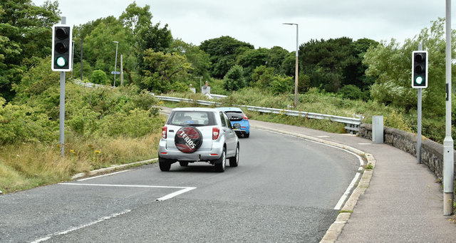
Railway bridge, Ballycarry station - August 2018(2)
Traffic lights on the Islandmagee side.
Road bridge, Ballycarry station
A hump bridge, carrying the Island Road Lower/Lough Road across the railway, at the Larne Harbour end of Ballycarry station. Safety improvements, involving single-line traffic controlled by lights, road narrowing and widening the footpath were completed at the end of 2015. The bridge walls were raised.
![Creative Commons Licence [Some Rights Reserved]](https://s1.geograph.org.uk/img/somerights20.gif)
|
· Find out How to reuse this image ·
Share:
|
|||||
| Start a discussion on J4694 | Suggest an update to this image | Contact the contributor | |||
Loading map... (JavaScript required)
- Grid Square
- J4694, 32 images (more nearby
 )
)
- Photographer
- Albert Bridge (find more nearby)
- Date Taken
- Thursday, 2 August, 2018 (more nearby)
- Submitted
- Thursday, 2 August, 2018
- Geographical Context
- Place (from Tags)
- Railway (from Tags)
- Primary Subject of Photo
- Subject Location
-
Irish:
 J 464 945 [100m precision]
WGS84: 54:46.6594N 5:43.4918W - Camera Location
-
Irish: J 464 945
- View Direction
- West-southwest (about 247 degrees)
Other Tags
This page has been viewed about 54 times.
View this location:
KML (Google Earth) ·
Google Maps ·
Bing Maps ·
Geograph Coverage Map ·
More Links for this image
·
Bing Maps ·
Geograph Coverage Map ·
More Links for this image