J1580 : C-FFPH, Aldergrove (August 2018)
taken 6 years ago, near to Killead, Co Antrim, Northern Ireland
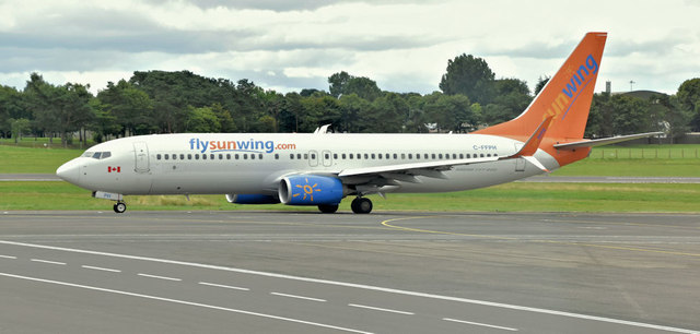
C-FFPH, Aldergrove (August 2018)
Thomson Airways/Sunwing Airlines Boeing 737 (C-FFPH) departing to Las Palmas.
Belfast International (Aldergrove) Airport
Commonly known as Aldergrove, Belfast International Airport opened as a military airfield in 1917. It became Belfasts civil airport in 1963 replacing that at Nutts Corner Link
. Currently (July 2016) served by easyJet, Jet2, Ryanair, Thomas Cook, United Airlines and Wizz Air. There are numerous seasonal holiday charters to many European and trans-Atlantic destinations. This link is to the official website Link
![Creative Commons Licence [Some Rights Reserved]](https://s1.geograph.org.uk/img/somerights20.gif)
|
· Find out How to reuse this image ·
Share:
|
|||||
| Start a discussion on J1580 | Suggest an update to this image | Contact the contributor | |||
Loading map... (JavaScript required)
- Grid Square
- J1580, 155 images (more nearby
 )
)
- Photographer
- Albert Bridge (find more nearby)
- Date Taken
- Saturday, 4 August, 2018 (more nearby)
- Submitted
- Sunday, 5 August, 2018
- Geographical Context
- Place (from Tags)
- Primary Subject of Photo
- Subject Location
-
Irish:
 J 151 804 [100m precision]
WGS84: 54:39.5416N 6:13.0045W - Camera Location
-
Irish: J 150 806
- View Direction
- South-southeast (about 157 degrees)
Other Tags
This page has been viewed about 40 times.
View this location:
KML (Google Earth) ·
Google Maps ·
Bing Maps ·
Geograph Coverage Map ·
More Links for this image