2018
NO0242 : The River Tay
taken 6 years ago, near to Little Dunkeld, Perth And Kinross, Scotland
This is 1 of 4 images, with title The River Tay in this square
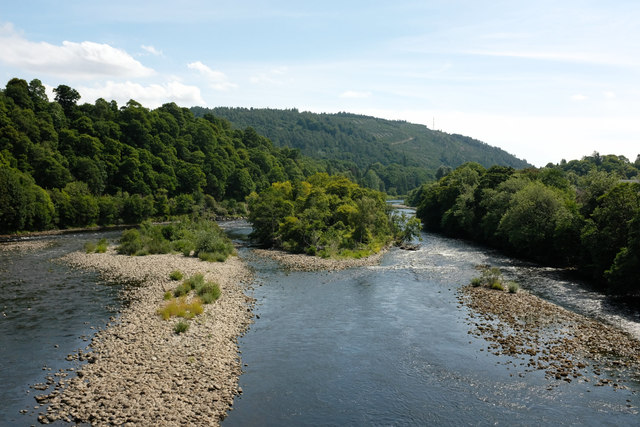
The River Tay
Looking downstream from Dunkeld Bridge. Water levels after a long dry spell are low exposing more of the central islands and rock spits than might normally be visible.
 Map © Crown Copyright")
TIP: Click the map for more Large scale mapping
- Grid Square
- NO0242, 435 images (more nearby 🔍)
- Photographer
- Martin Addison (more nearby)
- Date Taken
- Friday, 27 July, 2018 (more nearby)
- Submitted
- Wednesday, 8 August, 2018
- Subject Location
-
OSGB36:
 NO 0282 4241 [10m precision]
WGS84: 56:33.8134N 3:34.9740W - Camera Location
-
OSGB36: NO 0268 4242
- View Direction
- EAST (about 90 degrees)