2018
SJ7948 : Bateswood at sunrise
taken 6 years ago, near to Halmer End, Staffordshire, England
This is 1 of 11 images, with title starting with Bateswood in this square
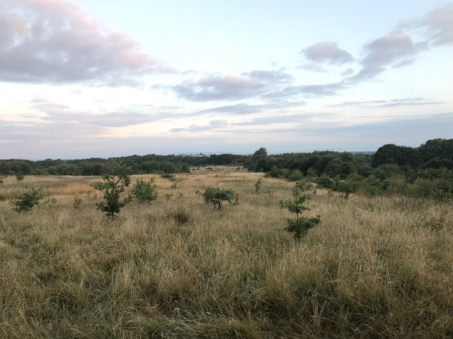
Bateswood at sunrise
Bateswood Country Park, north-west of Newcastle-under-Lyme in Staffordshire and adjacent to the village of Halmer End, is designated as a Local Nature Reserve (LNR). It was developed after the cessation of opencast mining in the 1990s, which left the area as a barren wasteland with poor quality soil. Birch reforestation and the creation of a lake have improved the habitat for wildlife, while a network of footpaths and a bridle path create access to most parts of the site. In 2012 managed fishing by a local angling club was permitted, in an attempt to curb illicit fishing.
The site is managed by Newcastle Borough Council in partnership with Halmer End Wildlife Trust, a group of volunteers.
This site is not to be confused with Staffordshire Wildlife Trust's reserve immediately to the south, also called Bateswood (see Link.
See other images of Bateswood Country Park
The site is managed by Newcastle Borough Council in partnership with Halmer End Wildlife Trust, a group of volunteers.
This site is not to be confused with Staffordshire Wildlife Trust's reserve immediately to the south, also called Bateswood (see Link.
See other images of Bateswood Country Park
 Map © Crown Copyright")
TIP: Click the map for more Large scale mapping
- Grid Square
- SJ7948, 216 images (more nearby 🔍)
- Photographer
- Jonathan Hutchins (more nearby)
- Date Taken
- Tuesday, 17 July, 2018 (more nearby)
- Submitted
- Friday, 24 August, 2018
- Subject Location
-
OSGB36:
 SJ 7977 4886 [10m precision]
WGS84: 53:2.1978N 2:18.1885W - Camera Location
-
OSGB36: SJ 79924 48769
- View Direction
- West-northwest (about 292 degrees)