H9820 : The northern end of Tullymacreeve Road
taken 6 years ago, 6 km E of Cullyhanna, Co Armagh, Northern Ireland
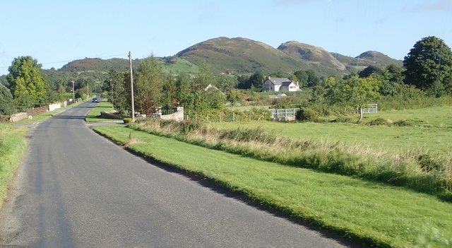
The northern end of Tullymacreeve Road
Slievenacappel, a part of the Ring of Gullion, forms the background.
Ring of Gullion
The Slieve Gullion ring dyke was formed some 400 million years ago as the result of a catastrophic volcanic explosion. This destroyed the central volcano leaving behind a circle of hills radiating around the main caldera.
Link
Link
![Creative Commons Licence [Some Rights Reserved]](https://s1.geograph.org.uk/img/somerights20.gif)
|
· Find out How to reuse this image ·
Share:
|
|||||
| Start a discussion on H9820 | Suggest an update to this image | Contact the contributor | |||
Loading map... (JavaScript required)
- Grid Square
- H9820, 17 images (more nearby
 )
)
- Photographer
- Eric Jones (find more nearby)
- Date Taken
- Wednesday, 12 September, 2018 (more nearby)
- Submitted
- Sunday, 16 September, 2018
- Geographical Context
- Subject Location
-
Irish:
 H 981 207 [100m precision]
WGS84: 54:7.5842N 6:29.9762W - Camera Location
-
Irish: H 982 203
- View Direction
- North-northwest (about 337 degrees)
This page has been viewed about 23 times.
View this location:
KML (Google Earth) ·
Google Maps ·
Bing Maps ·
Geograph Coverage Map ·
More Links for this image
·
Bing Maps ·
Geograph Coverage Map ·
More Links for this image