2018
NY2015 : Sheepfold on Buttermere Fell
taken 6 years ago, 3 km from Buttermere, Cumbria, England
Sheepfold on Buttermere Fell
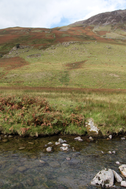
A circular stone-wall sheepfold at the upper left of the rough pasture on the slopes of Littledale Edge can just be made out below the rock outcrops. The higher ground to the right is Hindscarth Edge in NY2115.
The river in the foreground is Gatesgarthdale Beck, in the viewpoint square NY2014. Note the typical fell flora: short growing bracken, rough grass and darker green upright rushes. The water in the Beck is incredibly clear.
The river in the foreground is Gatesgarthdale Beck, in the viewpoint square NY2014. Note the typical fell flora: short growing bracken, rough grass and darker green upright rushes. The water in the Beck is incredibly clear.
 Map © Crown Copyright")
TIP: Click the map for more Large scale mapping
- Grid Square
- NY2015, 10 images (more nearby 🔍)
- Photographer
- Kate Jewell (more nearby)
- Date Taken
- Saturday, 8 September, 2018 (more nearby)
- Submitted
- Sunday, 16 September, 2018
- Subject Location
-
OSGB36:
 NY 20502 15439 [1m precision]
WGS84: 54:31.6781N 3:13.7937W - Camera Location
-
OSGB36: NY 20987 14848
- View Direction
- Northwest (about 315 degrees)