2018
NY3022 : Low Rigg from Castlerigg Stone Circle
taken 6 years ago, 3 km from Threlkeld, Cumbria, England
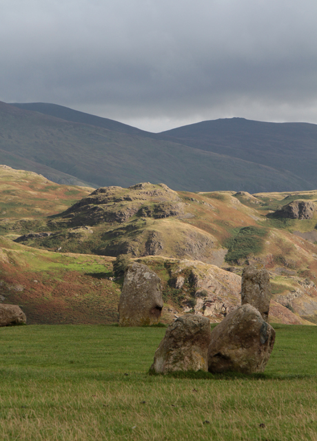
Low Rigg from Castlerigg Stone Circle
The stone circle field is surrounded by a dramatic landscape, something to inspire the neolithic builders to choose this spot perhaps. Low Rigg, lit up by the sun across the centre of the photograph, is in the featured square. The foreground is in the viewpoint square. In-between the land falls away to the Naddle Beck valley, NY2923 : Looking upstream from Naddle Bridge Beyond are Clough Head and Great Dodd, part of the High Fells leading to Helvellyn.
 Map © Crown Copyright")
TIP: Click the map for more Large scale mapping
- Grid Square
- NY3022, 87 images (more nearby 🔍)
- Photographer
- Kate Jewell (more nearby)
- Date Taken
- Sunday, 9 September, 2018 (more nearby)
- Submitted
- Tuesday, 18 September, 2018
- Subject Location
-
OSGB36:
 NY 3017 2291 [10m precision]
WGS84: 54:35.7915N 3:4.9390W - Camera Location
-
OSGB36: NY 2910 2363
- View Direction
- Southeast (about 135 degrees)