N8056 : Ruined tower, Trim Castle
taken 6 years ago, near to Trim, Co Meath, Ireland
This is 1 of 3 images, with title Ruined tower, Trim Castle in this square
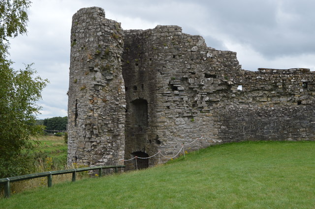
Ruined tower, Trim Castle
Trim Castle is a Norman castle on the south bank of the River Boyne in Trim, County Meath. With an area of 30,000 m², it is the largest Norman castle in Ireland. Over a period of 50 years, from 1172 to 1224, it was built by Hugh de Lacy and his son Walter as the seat of the Lordship of Meath.
One of the National Monuments of Ireland.
Wikipedia:Link
See other images of Trim Castle
One of the National Monuments of Ireland.
Wikipedia:Link
See other images of Trim Castle
![Creative Commons Licence [Some Rights Reserved]](https://s1.geograph.org.uk/img/somerights20.gif)
|
· Find out How to reuse this image ·
Share:
|
|||||
| Start a discussion on N8056 | Suggest an update to this image | Contact the contributor | |||
Loading map... (JavaScript required)
- Grid Square
- N8056, 128 images (more nearby
 )
)
- Photographer
- N Chadwick (find more nearby)
- Date Taken
- Thursday, 2 August, 2018 (more nearby)
- Submitted
- Wednesday, 26 September, 2018
- Geographical Context
- Subject Location
-
Irish:
 N 803 566 [100m precision]
WGS84: 53:33.2346N 6:47.3118W - Camera Location
-
Irish: N 803 566
- View Direction
- Southeast (about 135 degrees)
This page has been viewed about 17 times.
View this location:
KML (Google Earth) ·
Google Maps ·
Bing Maps ·
Geograph Coverage Map ·
More Links for this image