2018
NX8881 : Steilston Hill seen across Loweberry Loch
taken 6 years ago, near to Newtonairds, Dumfries And Galloway, Scotland
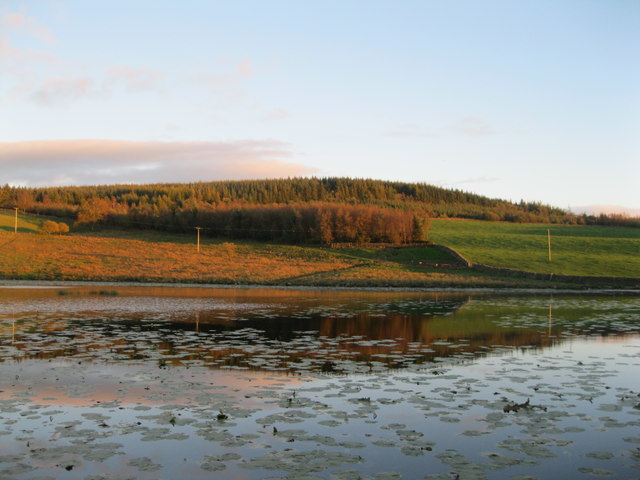
Steilston Hill seen across Loweberry Loch
Loweberry Loch was a natural pool, enlarged in the 19th century by building a dam wall, to provide an enhanced supply to a water-powered sawmill, at the Home farm, on the Newtonairds estate.
 Map © Crown Copyright")
TIP: Click the map for more Large scale mapping
- Grid Square
- NX8881, 11 images (more nearby 🔍)
- Photographer
- Graham Ovens (more nearby)
- Date Taken
- Saturday, 6 October, 2018 (more nearby)
- Submitted
- Sunday, 7 October, 2018
- Subject Location
-
OSGB36:
 NX 8831 8157 [10m precision]
WGS84: 55:6.9538N 3:45.1588W - Camera Location
-
OSGB36: NX 8820 8165
- View Direction
- Southeast (about 135 degrees)