2018
NZ6814 : Moorsholm Docks
taken 6 years ago, near to Moorsholm, Redcar And Cleveland, England
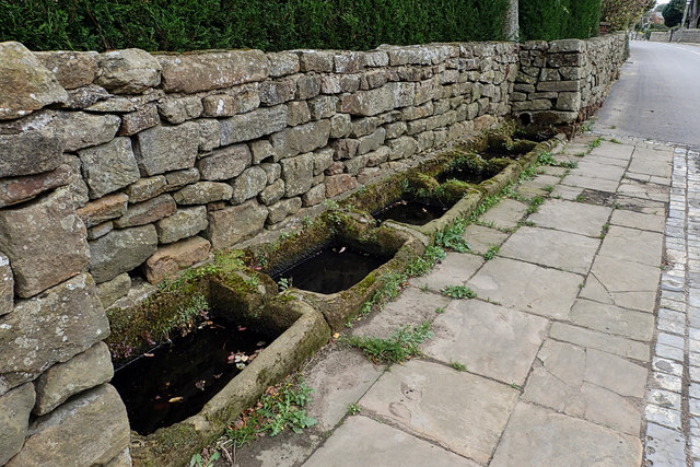
Moorsholm Docks
Right on the High Street of this delightful little village that just missed out on the ironstone mining activities of the rest of East Cleveland, is a row of six sunken sandstone water troughs that have become known as the Moorsholm Docks. Probably dating from the 19th-century they are fed by piped water from a spring on the moors. The name seems to be a bit of a mystery; some suggest it came about purely as a result of a wag.
From my blog Link
From my blog Link
 Map © Crown Copyright")
TIP: Click the map for more Large scale mapping
- Grid Square
- NZ6814, 12 images (more nearby 🔍)
- Photographer
- Mick Garratt (more nearby)
- Date Taken
- Thursday, 4 October, 2018 (more nearby)
- Submitted
- Sunday, 7 October, 2018
- Subject Location
-
OSGB36:
 NZ 689 144 [100m precision]
WGS84: 54:31.2562N 0:56.2153W - Camera Location
-
OSGB36: NZ 689 144
- View Direction
- South-southeast (about 157 degrees)