2018
SE0063 : Linton: Lower weir in drought
taken 6 years ago, near to Grassington, North Yorkshire, England
This is 1 of 31 images, with title starting with Linton in this square
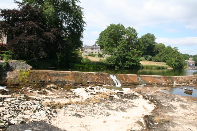
Linton: Lower weir in drought
Very rarely is the River Wharfe seen in such conditions, with hardly any water coming over the weir.
 Map © Crown Copyright")
TIP: Click the map for more Large scale mapping
- Grid Square
- SE0063, 495 images (more nearby 🔍)
- Photographer
- Dr Neil Clifton (more nearby)
- Date Taken
- Sunday, 15 July, 2018 (more nearby)
- Submitted
- Sunday, 14 October, 2018
- Subject Location
-
OSGB36:
 SE 0007 6334 [10m precision]
WGS84: 54:3.9600N 2:0.0254W - Camera Location
-
OSGB36: SE 0012 6334
- View Direction
- WEST (about 270 degrees)