2018
ST9406 : RAF Tarrant Rushton - the remains of an historic airfield (2)
taken 5 years ago, near to Tarrant Rawston, Dorset, England
RAF Tarrant Rushton - the remains of an historic airfield (2)
-
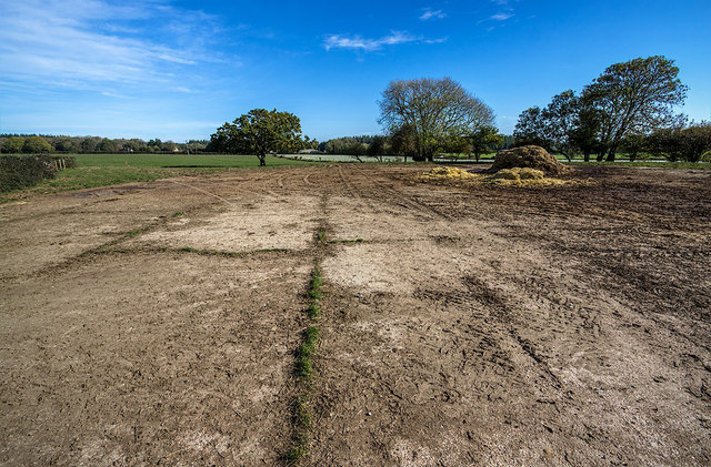
"Frying Pan" Dispersal
One of two circular dispersals dating from when the airfield was built in 1943, approached by a short offshoot from the peri-track at the north end. Having a diameter of around 130 ft (40 m), it is the sole survivor of the two, its outline is still visible from the air. Google Earth view: Link
ST9406 : RAF Tarrant Rushton - the remains of an historic airfield (3)
 Map © Crown Copyright")
TIP: Click the map for more Large scale mapping
- Grid Square
- ST9406, 26 images (more nearby 🔍)
- Photographer
- Mike Searle (more nearby)
- Date Taken
- Wednesday, 24 October, 2018 (more nearby)
- Submitted
- Saturday, 27 October, 2018
- Subject Location
-
OSGB36:
 ST 9476 0654 [10m precision]
WGS84: 50:51.5008N 2:4.5490W - Camera Location
-
OSGB36: ST 9474 0653
- View Direction
- EAST (about 90 degrees)