J3774 : Pim's Avenue, Belfast
taken 16 years ago, 3 km from Belfast, Co Antrim, Northern Ireland
Pim's Avenue, Belfast
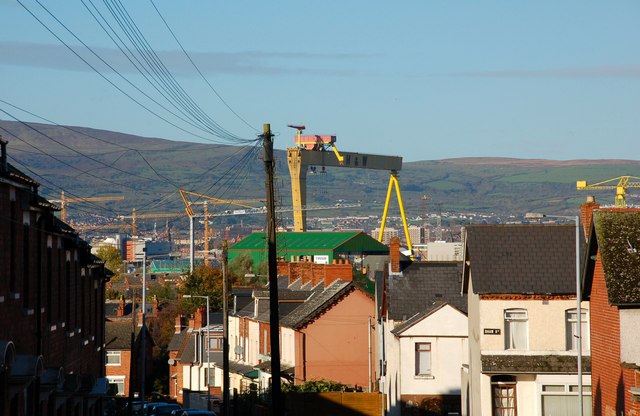
Pims Avenue runs from the Holywood Road at Gelstons Corner to Connsbrook Avenue. The Harland & Wolff crane Samson and the Oval stand dominate the background.
![Creative Commons Licence [Some Rights Reserved]](https://s1.geograph.org.uk/img/somerights20.gif)
|
· Find out How to reuse this image ·
Share:
|
|||||
| Start a discussion on J3774 | Suggest an update to this image | Contact the contributor | |||
Loading map... (JavaScript required)
- Grid Square
- J3774, 464 images (more nearby
 )
)
- Photographer
- Albert Bridge (find more nearby)
- Date Taken
- Sunday, 28 October, 2007 (more nearby)
- Submitted
- Sunday, 28 October, 2007
- Category
- Street (more nearby)
- Subject Location
-
Irish:
 J 370 745 [100m precision]
WGS84: 54:36.0412N 5:52.8320W - Camera Location
-
Irish: J 370 745
- View Direction
- Northwest (about 315 degrees)
Image classification(about):
Supplemental image
This page has been viewed about 127 times.
View this location:
KML (Google Earth) ·
Google Maps ·
Bing Maps ·
Geograph Coverage Map ·
More Links for this image
·
Bing Maps ·
Geograph Coverage Map ·
More Links for this image