2015
SP5970 : Grand Union Canal: Leicester Section: Bridge Number 10
taken 9 years ago, near to Crick, West Northamptonshire, England
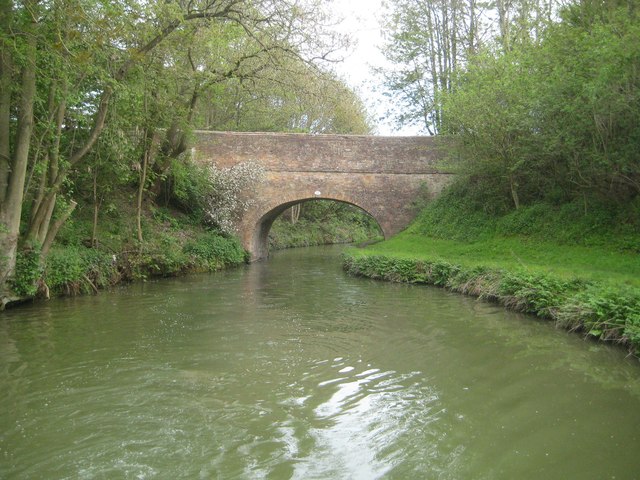
Grand Union Canal: Leicester Section: Bridge Number 10
This crossing of the canal is known as the horse path bridge. It is part of the original canal infrastructure and probably dates from no later than 1814 when the route was opened. It is one of many Grade II Listed bridges along the canal.
 Map © Crown Copyright")
TIP: Click the map for more Large scale mapping
- Grid Square
- SP5970, 47 images (more nearby 🔍)
- Photographer
- Nigel Cox (more nearby)
- Date Taken
- Friday, 8 May, 2015 (more nearby)
- Submitted
- Friday, 9 November, 2018
- Subject Location
-
OSGB36:
 SP 5916 7069 [10m precision]
WGS84: 52:19.8671N 1:7.9959W - Camera Location
-
OSGB36: SP 5917 7066
- View Direction
- North-northwest (about 337 degrees)