2016
TQ4986 : Dagenham: The Ship & Anchor, Becontree Heath
taken 8 years ago, near to Becontree, Barking And Dagenham, England
Dagenham: The Ship & Anchor, Becontree Heath
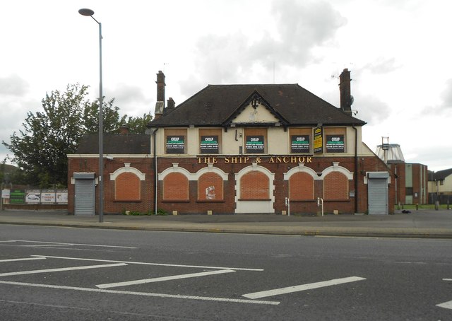
This is The Ship & Anchor public house as most definitely closed (bricked up, not boarded up, ground floor windows for example) in June 2016.
Elsewhere on the internet is a description of the pub giving the names of all the occupants as of each Census from 1851 to 1911.
Unfortunately the pub is not present on any of the old large scale Ordnance Survey maps available on line, up to and including that of 1920. The building first appears as an unnamed PH on the map of 1938, and then appears as the "Hope & Anchor" PH in 1960 and 1961. Only in the 1990 edition does it show as the "Ship & Anchor".
The road in front is the A124 Wood Lane.
 Map © Crown Copyright")
TIP: Click the map for more Large scale mapping
- Grid Square
- TQ4986, 34 images (more nearby 🔍)
- Photographer
- Nigel Cox (more nearby)
- Date Taken
- Thursday, 30 June, 2016 (more nearby)
- Submitted
- Sunday, 11 November, 2018
- Subject Location
-
OSGB36:
 TQ 4903 8692 [10m precision]
WGS84: 51:33.6885N 0:8.9137E - Camera Location
-
OSGB36: TQ 4904 8688
- View Direction
- North-northwest (about 337 degrees)