2018
SK4033 : Borrowash weir is dry
taken 5 years ago, near to Borrowash, Derbyshire, England
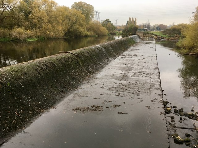
Borrowash weir is dry
For maintenance I assumed, but talking to an Environment Agency worker a few days later I was told that it's simply due to the river being low.
 Map © Crown Copyright")
TIP: Click the map for more Large scale mapping
- Grid Square
- SK4033, 89 images (more nearby 🔍)
- Photographer
- David Lally (more nearby)
- Date Taken
- Tuesday, 6 November, 2018 (more nearby)
- Submitted
- Monday, 12 November, 2018
- Subject Location
-
OSGB36:
 SK 4046 3395 [10m precision]
WGS84: 52:54.0884N 1:23.9964W - Camera Location
-
OSGB36: SK 40432 33869
- View Direction
- North-northeast (about 22 degrees)