SX4855 : Box junction, B3214, B3238
taken 6 years ago, near to Plymouth, England
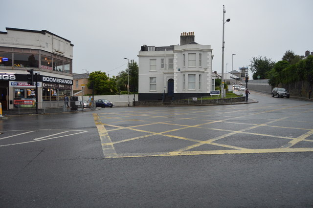
A box junction is a traffic control measure designed to prevent gridlock at busy road junctions. The surface of the junction is marked with a criss-cross grid of diagonal painted lines and vehicles may not enter the area so marked unless their exit from the junction is clear; drivers may enter the box and wait when they want to turn right and are stopped from doing so only by oncoming traffic or by other vehicles waiting to turn right. Link
The B3238 is a local road on the eastern side of Plymouth city centre, linking the B3214 Road and B3250 Road at Mutley Plain SX4855 : B3238, Mutley to the A374 Road and A379 road at Cattedown roundabout SX4854 : Tothill Rd, B3238 in St Jude's by way of Greenbank.
The route used to be a very important one in serving the city's main fire and ambulance stations as well as two hospitals, of which one included a casualty department. Of these establishments, only the fire station remains sited on this road.
The B3214 is a short link road in Plymouth. It runs 1.6 miles from Laira SX5055 : B3214 to Mutley Plain. SX4855 : B3214, Mutley
Link
 Map © Crown Copyright")
- Grid Square
- SX4855, 584 images (more nearby 🔍)
- Photographer
- N Chadwick (more nearby)
- Date Taken
- Thursday, 31 May, 2018 (more nearby)
- Submitted
- Thursday, 22 November, 2018
- Subject Location
-
OSGB36:
 SX 4841 5555 [10m precision]
WGS84: 50:22.8154N 4:8.0066W - Camera Location
-
OSGB36: SX 4839 5555
- View Direction
- EAST (about 90 degrees)