2018
SW3621 : Exploring Porthgwarra
taken 6 years ago, near to St Levan, Cornwall, England
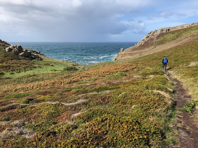
Exploring Porthgwarra
A network of footpaths snakes through the maritime heath at Porthgwarra.
 Map © Crown Copyright")
TIP: Click the map for more Large scale mapping
- Grid Square
- SW3621, 70 images (more nearby 🔍)
- Photographer
- Katie (more nearby)
- Date Taken
- Friday, 21 September, 2018 (more nearby)
- Submitted
- Tuesday, 27 November, 2018
- Subject Location
-
OSGB36:
 SW 3657 2199 [10m precision]
WGS84: 50:2.3771N 5:40.8268W - Camera Location
-
OSGB36: SW 36606 21984
- View Direction
- West-northwest (about 292 degrees)