2018
SE0427 : The top of Halifax FP175 at Bank House Lane, Warley
taken 5 years ago, near to Wainstalls, Calderdale, England
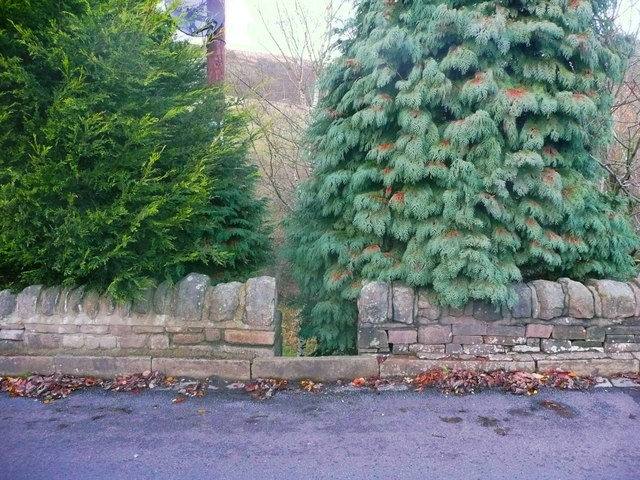
The top of Halifax FP175 at Bank House Lane, Warley
This path is unusable. It is shown on the 1894 1:2500 map. but there must have been steps as it is extremely steep and the bottom end is at the top of a retaining wall.
 Map © Crown Copyright")
TIP: Click the map for more Large scale mapping
- Grid Square
- SE0427, 128 images (more nearby 🔍)
- Photographer
- Humphrey Bolton (more nearby)
- Date Taken
- Friday, 30 November, 2018 (more nearby)
- Submitted
- Friday, 30 November, 2018
- Subject Location
-
OSGB36:
 SE 0409 2796 [10m precision]
WGS84: 53:44.8798N 1:56.3676W - Camera Location
-
OSGB36: SE 0409 2796
- View Direction
- NORTH (about 0 degrees)