2007
NJ4306 : Burn of Migvie
taken 17 years ago, near to Migvie, Aberdeenshire, Scotland
Burn of Migvie
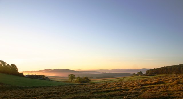
Sunrise, day after barley harvested. Showing the early morning mist filling the Burn of Migvie valley and Muir of Dinnet in the background.
 Map © Crown Copyright")
TIP: Click the map for more Large scale mapping
- Grid Square
- NJ4306, 65 images (more nearby 🔍)
- Photographer
- The Fergs (more nearby)
- Date Taken
- Tuesday, 2 October, 2007 (more nearby)
- Submitted
- Thursday, 1 November, 2007
- Subject Location
-
OSGB36:
 NJ 4357 0642 [10m precision]
WGS84: 57:8.7111N 2:56.0508W - Camera Location
-
OSGB36: NJ 4339 0661
- View Direction
- Southeast (about 135 degrees)