2007
SW8236 : The Carrick Roads (West) in the Falmouth Estuary
taken 17 years ago, near to Mylor Churchtown, Cornwall, England
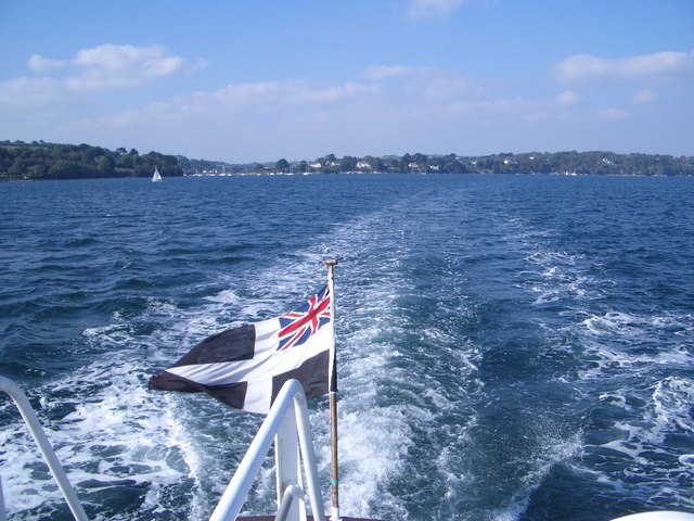
The Carrick Roads (West) in the Falmouth Estuary
Photographed from the Truro/Falmouth Ferry travelling southwards, and using GPS, this view from the Carrick Roads looks towards Restronguet Point and Creek, left of centre.
 Map © Crown Copyright")
TIP: Click the map for more Large scale mapping
- Grid Square
- SW8236, 5 images (more nearby 🔍)
- Photographer
- Nigel Stickells (more nearby)
- Date Taken
- Saturday, 6 October, 2007 (more nearby)
- Submitted
- Friday, 2 November, 2007
- Subject Location
-
OSGB36:
 SW 8251 3623 [10m precision]
WGS84: 50:11.1643N 5:2.8810W - Camera Location
-
OSGB36: SW 8251 3623
- View Direction
- Northwest (about 315 degrees)