2014
ST4836 : The Grange, Street
taken 10 years ago, near to Street, Somerset, England
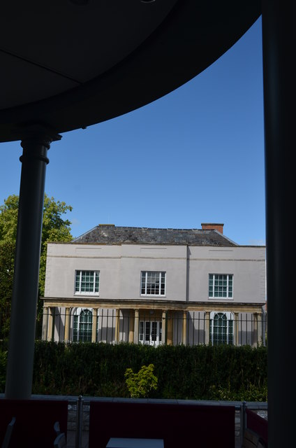
The Grange, Street
Now slightly overwhelmed by the Clarks Shopping Village from where this picture was taken, The Grange is a Grade II listed property. Originally a house connected with the Abbey at Wells it was rebuilt for Strode family circa 1650 and then refronted for Brown family in around 1810. It is now occupied by the Alfred Gillett Trust who are the custodians of the Clark's family and business heritage collections and is open to the public on weekdays.
 Map © Crown Copyright")
TIP: Click the map for more Large scale mapping
- Grid Square
- ST4836, 396 images (more nearby 🔍)
- Photographer
- Colin Cheesman (more nearby)
- Date Taken
- Monday, 28 July, 2014 (more nearby)
- Submitted
- Sunday, 13 January, 2019
- Subject Location
-
OSGB36:
 ST 482 369 [100m precision]
WGS84: 51:7.7524N 2:44.4550W - Camera Location
-
OSGB36: ST 482 369
- View Direction
- Northwest (about 315 degrees)