O1533 : New Bride St
taken 6 years ago, near to Harolds Cross, Dublin, Ireland
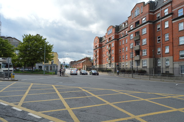
New Bride St
A box junction is a traffic control measure designed to prevent gridlock at busy road junctions. The surface of the junction is marked with a criss-cross grid of diagonal painted lines and vehicles may not enter the area so marked unless their exit from the junction is clear; drivers may enter the box and wait when they want to turn right and are stopped from doing so only by oncoming traffic or by other vehicles waiting to turn right. Link
See other images of Box Junction
See other images of Box Junction
![Creative Commons Licence [Some Rights Reserved]](https://s1.geograph.org.uk/img/somerights20.gif)
|
· Find out How to reuse this image ·
Share:
|
|||||
| Start a discussion on O1533 | Suggest an update to this image | Contact the contributor | |||
Loading map... (JavaScript required)
- Grid Square
- O1533, 636 images (more nearby
 )
)
- Photographer
- N Chadwick (find more nearby)
- Date Taken
- Friday, 3 August, 2018 (more nearby)
- Submitted
- Saturday, 19 January, 2019
- Geographical Context
- Subject Location
-
Irish:
 O 153 333 [100m precision]
WGS84: 53:20.2727N 6:16.1611W - Camera Location
-
Irish: O 153 333
- View Direction
- SOUTH (about 180 degrees)
This page has been viewed about 31 times.
View this location:
KML (Google Earth) ·
Google Maps ·
Bing Maps ·
Geograph Coverage Map ·
More Links for this image