2007
SU1431 : Old Milestone by the A345, Castle Road, Salisbury
taken 17 years ago, near to Salisbury, Wiltshire, England
Old Milestone by the A345, Castle Road, Salisbury
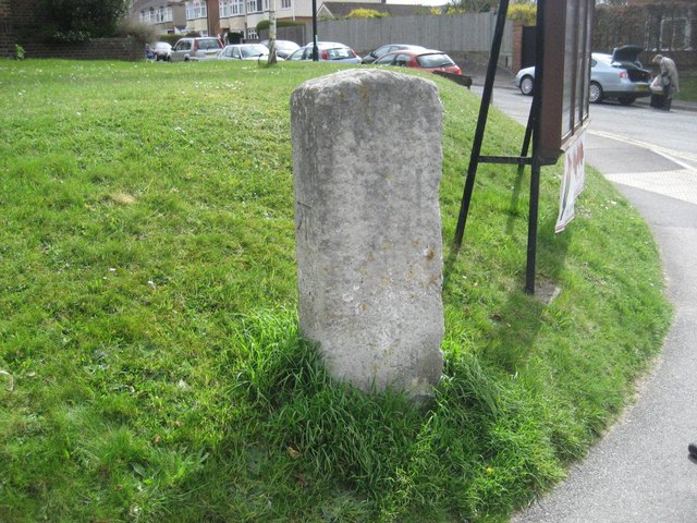
Carved stone post by the A345, in parish of SALISBURY (SALISBURY District), Pauls Dene, junction of Castle Road and Beatrice Road, on cut grass bank, on East side of road. Salisbury Roman stone, erected by the Marlborough & Salisbury turnpike trust in the 18th century.
Inscription once read:-
: (To / Saliſbury / I / Mile) : : To / Marlbro / XXVI) / (17)48 :
Carved benchmark on left face.
Grade II listed. List Entry Number: 1243653
Link
Milestone Society National ID: WI_MLSA26.
Inscription once read:-
: (To / Saliſbury / I / Mile) : : To / Marlbro / XXVI) / (17)48 :
Carved benchmark on left face.
Grade II listed. List Entry Number: 1243653
Link
Milestone Society National ID: WI_MLSA26.
National Survey of Wayside Features by The Milestone Society
These images are from Link
 Map © Crown Copyright")
TIP: Click the map for more Large scale mapping
- Grid Square
- SU1431, 56 images (more nearby 🔍)
- Photographer
- M Faherty (more nearby)
- Contributed by
- Milestone Society (more nearby)
- Date Taken
- Saturday, 20 January, 2007 (more nearby)
- Submitted
- Tuesday, 29 January, 2019
- Subject Location
-
OSGB36:
 SU 14307 31529 [1m precision]
WGS84: 51:4.9743N 1:47.8276W - Camera Location
-
OSGB36: SU 14307 31529
- View Direction
- East-southeast (about 112 degrees)