2016
NG1554 : Geodha na Gliongraich
taken 8 years ago, 3 km from Galtrigill, Isle of Skye, Scotland
This is 1 of 3 images, with title Geodha na Gliongraich in this square
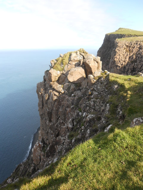
Geodha na Gliongraich
Pinnacle at the southern bound of Geodha na Gliongraich, a geo or gully 400m south of the summit of Biod an Athair.
 Map © Crown Copyright")
TIP: Click the map for more Large scale mapping
- Grid Square
- NG1554, 22 images (more nearby 🔍)
- Photographer
- John Little (more nearby)
- Date Taken
- Monday, 19 September, 2016 (more nearby)
- Submitted
- Saturday, 9 February, 2019
- Subject Location
-
OSGB36:
 NG 1584 5493 [10m precision]
WGS84: 57:29.7099N 6:44.6786W - Camera Location
-
OSGB36: NG 1571 5456
- View Direction
- North-northeast (about 22 degrees)