2019
TQ5739 : Higher Common Cricket Ground, Tunbridge Wells
taken 5 years ago, near to Royal Tunbridge Wells, Kent, England
Higher Common Cricket Ground, Tunbridge Wells
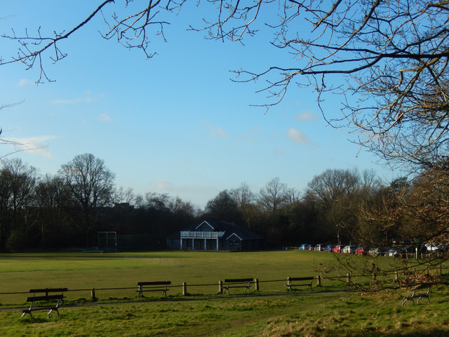
This cricket ground on Tunbridge Wells Common is home to Linden Park Cricket Club although it was used in the 19th century to stage Kent county matches. The pavilion dates from 2008, the previous building having been destroyed by arson.
Tunbridge Wells Common :: TQ5839
Tunbridge Wells Common is a 104 hectare open space close to the centre of town. Comprising mixed oak woodland and open areas. Originally a common where animals grazed, but trees have grown as grazing declined. Underlain by Tunbridge Wells Sandstone (Lower Cretaceous), which outcrops in several places across the common. Owned by the Borough Council but looked after by the Tunbridge Wells Common Conservators Link
.
 Map © Crown Copyright")
TIP: Click the map for more Large scale mapping
- Grid Square
- TQ5739, 845 images (more nearby 🔍)
- Photographer
- Stephen McKay (more nearby)
- Date Taken
- Thursday, 7 February, 2019 (more nearby)
- Submitted
- Monday, 11 February, 2019
- Subject Location
-
OSGB36:
 TQ 5771 3911 [10m precision]
WGS84: 51:7.7735N 0:15.1509E - Camera Location
-
OSGB36: TQ 5774 3918
- View Direction
- South-southwest (about 202 degrees)