2018
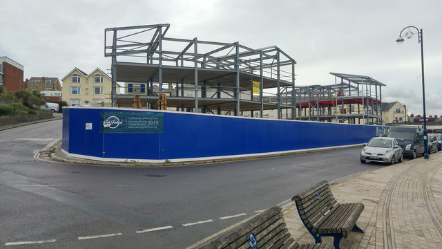
SZ0378 : Redevelopment of the Pier Head site, High Street, Swanage
taken 6 years ago, near to Swanage, Dorset, England
This is 1 of 2 images, with title Redevelopment of the Pier Head site, High Street, Swanage in this square
Redevelopment of the Pier Head site, High Street, Swanage
This was previously the site of the Pier Head building, built as a temporary mess hall in the 1940s. It was later used as a windsurfing school, cafe and bingo hall. The building had been empty and decaying since the 1990s.
In 2007 the building was decorated with trompe l'oeil murals depicting the past, present and possible future of the building.
Plans for redevelopment of the site were approved in 2017 and 2018. The new building will house apartments and retail units.
In 2007 the building was decorated with trompe l'oeil murals depicting the past, present and possible future of the building.
Plans for redevelopment of the site were approved in 2017 and 2018. The new building will house apartments and retail units.
 Map © Crown Copyright")
TIP: Click the map for more Large scale mapping
- Grid Square
- SZ0378, 836 images (more nearby 🔍)
- Photographer
- Phil Champion (more nearby)
- Date Taken
- Wednesday, 12 September, 2018 (more nearby)
- Submitted
- Saturday, 16 February, 2019
- Subject Location
-
OSGB36:
 SZ 0339 7863 [10m precision]
WGS84: 50:36.4427N 1:57.2072W - Camera Location
-
OSGB36: SZ 03423 78638
- View Direction
- WEST (about 270 degrees)