2004
ST4308 : Old Milestone B3165, Clapton Road, Crewkerne
taken 19 years ago, near to Hewish, Somerset, England
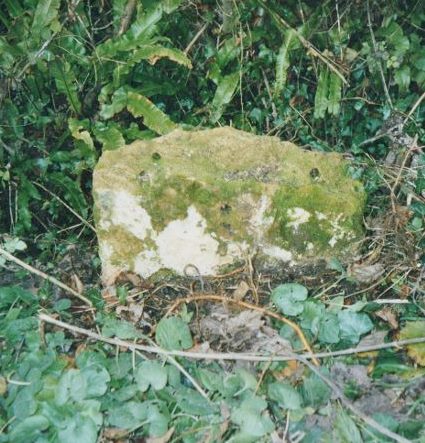
Old Milestone B3165, Clapton Road, Crewkerne
The milestone is located near Folly farm on the grass verge on the north west side of the road. Parish of West Crewkerne (South Somerset District). Stone post (plate lost), Crewkerne iron plate design, erected by the Crewkerne turnpike trust in the 19th century.
Broken.
Inscription once read:-
15 / Lyme / Crewkerne / 1
Somerset HER listed, HER number: 14085 Link
Milestone Society National ID: SO_CWLY01
Broken.
Inscription once read:-
15 / Lyme / Crewkerne / 1
Somerset HER listed, HER number: 14085 Link
Milestone Society National ID: SO_CWLY01
National Survey of Wayside Features by The Milestone Society
These images are from Link
 Map © Crown Copyright")
TIP: Click the map for more Large scale mapping
- Grid Square
- ST4308, 14 images (more nearby 🔍)
- Photographer
- JR Dowding (more nearby)
- Contributed by
- Milestone Society (more nearby)
- Date Taken
- Friday, 3 December, 2004 (more nearby)
- Submitted
- Tuesday, 26 February, 2019
- Subject Location
-
OSGB36:
 ST 43400 08493 [1m precision]
WGS84: 50:52.3891N 2:48.3466W - Camera Location
-
OSGB36: ST 43400 08493
- View Direction
- North-northwest (about 337 degrees)