2019
NH3709 : Drained canal, by Fort Augustus
taken 5 years ago, near to Fort Augustus, Highland, Scotland
This is 1 of 2 images, with title starting with Drained in this square
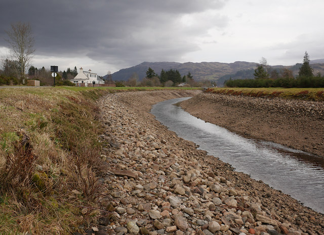
Drained canal, by Fort Augustus
Looking east along the Caledonian Canal, as it curves around towards Fort Augustus. This section of the canal has been drained, to allow for work on the lock gates.
 Map © Crown Copyright")
TIP: Click the map for more Large scale mapping
- Grid Square
- NH3709, 293 images (more nearby 🔍)
- Photographer
- Craig Wallace (more nearby)
- Date Taken
- Friday, 22 February, 2019 (more nearby)
- Submitted
- Wednesday, 27 February, 2019
- Subject Location
-
OSGB36:
 NH 3726 0910 [10m precision]
WGS84: 57:8.6319N 4:41.4774W - Camera Location
-
OSGB36: NH 37245 09092
- View Direction
- East-northeast (about 67 degrees)