2019
SD9803 : Stepped water inlet to the Huddersfield Narrow Canal
taken 5 years ago, near to Mossley, Tameside, England
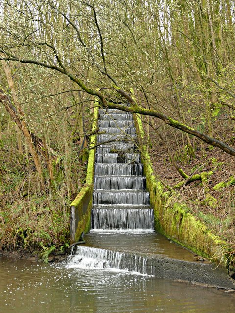
Stepped water inlet to the Huddersfield Narrow Canal
Quite an impressive waterfall following a period of heavy rain
Huddersfield Narrow Canal
The Huddersfield Narrow Canal opened in 1811. It runs for just under 20 miles from Lock 1E, where it joins the Huddersfield Broad Canal at the rear of the University of Huddersfield campus, to the junction with the Ashton Canal at Whitelands Basin in Ashton-under-Lyne. It crosses the Pennines by means of 74 locks and the Standedge Tunnel.
 Map © Crown Copyright")
TIP: Click the map for more Large scale mapping
- Grid Square
- SD9803, 94 images (more nearby 🔍)
- Photographer
- Graham Hogg (more nearby)
- Date Taken
- Monday, 18 March, 2019 (more nearby)
- Submitted
- Wednesday, 20 March, 2019
- Subject Location
-
OSGB36:
 SD 9803 0317 [10m precision]
WGS84: 53:31.5114N 2:1.8711W - Camera Location
-
OSGB36: SD 98017 03191
- View Direction
- Southeast (about 135 degrees)